Just how Long is the Thames Path?
You would think there would be a simple answer to this? But no.
It’s the same with the Pennine Way. Is it 250 miles? Or 270 miles? Opinions differ.
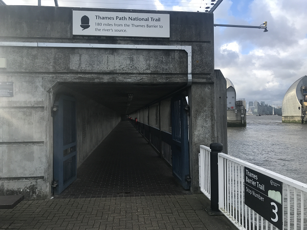
Officially, the Thames Path is 184 miles. That’s what the signposts say at the beginning and the end. It’s also what the National Trail website says.
Thames-path.org lists it at 180 miles, although if you add up all the sections it comes to 183 miles. Cicerone, the guide book, has it at 180 miles.
Rambling Man (a brilliant blog on various long distance walks) says it depends on whether you take the north bank or the south bank through London (or what I prefer to call the left bank and the right bank). For the left bank, he has a distance of 182.75. The right bank gives him 180.25. So 2.5 miles shorter on the right bank.

The National Trail’s official guide book also has the left bank with more mileage. They report a mileage of 185.5 (left bank) and 183.5 (right bank). So quite where the 184 comes from, who knows?
Unfortunately it’s not simple to reconcile. Some of the stages where there are differences are imprecise. For example, Thamespath.org includes a stage labelled “Cholsey to Dorchester”. In fact, the Thames Path does not go through these villages but skirts by them. Is that where the difference lies? Have some included diversions to nearest towns?
Then again the official Thames Path National Trail guide lists Tilehurst as a marker. But where does Tilehurst begin and end? The centre of Tilehurst is well off the Thames Path.

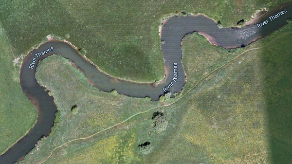
Aside from detours for beer and bed at Dorchester and Cholsey, the differences might be caused by the Thames meanders. Towards the upper end, the river makes some very small loops which can be cut short by walking directly across the fields, not following the strict curvature of the river. Many must have done this as the straight line paths are more worn than the curved paths. Could this account for a mile or two?
Then there’s the ongoing development work in London. Every few hundred yards the path is diverted behind the latest riverside development complex. Example: you can no longer walk along the riverside past Fulham football ground. You have to walk along three sides of the ground and past the ticketing shop, avoiding the temptation to witness the next enthralling chapter of the Championship season.
All these can add to deviations in route distances. But help is at hand. We have mapped out the distances on google maps, tracing the line of the paths, and come to the definitive answer. It’s 179.6 miles. Now, that’s assuming you take the right bank (south bank) as far as Tower Bridge, then cross the river at Tower Bridge to the north side (left bank) until you reach Island Gardens. Then, down the tunnel to the south side (right bank) at Greenwich for the summit bid to the Thames Barrier. Why? This is, in our opinion, the best route.
Once our route planner is online you will be able to see the 179.6 miles spread across our numerous break points. Break points are where the path meets a road. In the case of London, it’s every bridge. We have identified 102 break points across the 180 miles. Each break point will be shown on the interactive map in miles to 1 decimal point, e,g 103.6 miles. This will allow Thames Path walkers to accurately calculate, for the first time, how far they will or need to walk.
Ready to book?
| Cookie | Duration | Description |
|---|---|---|
| cookielawinfo-checkbox-analytics | 11 months | This cookie is set by GDPR Cookie Consent plugin. The cookie is used to store the user consent for the cookies in the category "Analytics". |
| cookielawinfo-checkbox-functional | 11 months | The cookie is set by GDPR cookie consent to record the user consent for the cookies in the category "Functional". |
| cookielawinfo-checkbox-necessary | 11 months | This cookie is set by GDPR Cookie Consent plugin. The cookies is used to store the user consent for the cookies in the category "Necessary". |
| cookielawinfo-checkbox-others | 11 months | This cookie is set by GDPR Cookie Consent plugin. The cookie is used to store the user consent for the cookies in the category "Other. |
| cookielawinfo-checkbox-performance | 11 months | This cookie is set by GDPR Cookie Consent plugin. The cookie is used to store the user consent for the cookies in the category "Performance". |
| viewed_cookie_policy | 11 months | The cookie is set by the GDPR Cookie Consent plugin and is used to store whether or not user has consented to the use of cookies. It does not store any personal data. |