Thames Path
About the Thames Path
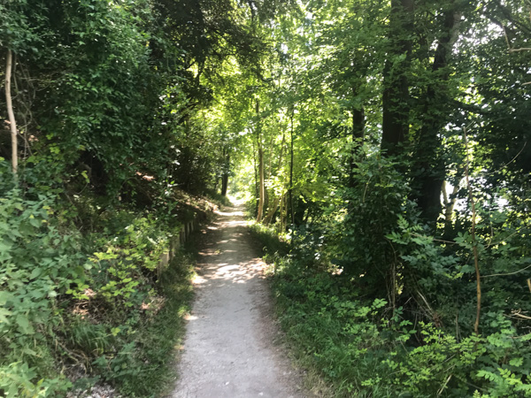
The Thames Path is a national trail and is therefore fully signposted. The Path is a public right of way at all times. It will either be a footpath, a bridleway or a road. You can walk or run on a footpath. You cannot cycle or ride a horse on a footpath: you need to be on a bridleway to do that. Also remember that the land you are crossing is private. So you need to keep to the footpath.
You cannot simply walk the Thames blindly. The Thames Path makes use of public rights of way that, for the most part, are next to the river. But not always. Sometimes the Thames Path leaves the river and works its way through a residential area rejoining the river. But these instances are rare and should not put you off what is an enjoyable walk.
The source of the Thames is only 110m above sea level. That’s 360 feet. As the route mostly follows the river it is not difficult to deduce that there will not be any hills. There is really only one: between Goring and Pangbourne when the path rises steeply above the river providing glorious views across Goring Gap where the river cuts through between the Chilterns and the Berkshire Downs.

Diversions are usually well signposted when first put up. However, over time, signs can disappear or, worse still, get turned around! For those in a package with us, you will receive full details of all diversions.
Don’t be put off by the diversions. It’s inevitable that, on a riverside walk of 180 miles, there will be a few at any point in time.
Diversions
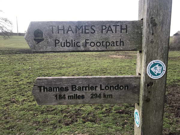
The Thames Path passes through some pretty damp territory. For weeks on end, bridges can be under water. And it’s not just the bridges that cross the Thames. Think about all the streams and channels that feed into the river. Each one requires a bridge. And there are a lot of them! So it’s not surprising that, from time to time, a bridge might fail and require replacing. It’s at this time that the Path will be diverted. You can see a complete list of all diversions here. Most diversions require minimal additional distance. The longest diversion is currently between Shiplake and Henley. The diversion lasts 3.5 miles, replacing 2.5 miles of the Thames Path.
In London, building developments can also cause temporary diversions. These tend to be easier to work around as there are plenty of parallel roads to use.
Thames Path: When to Go
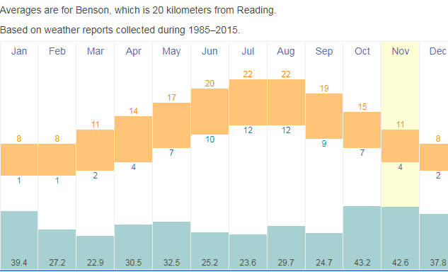
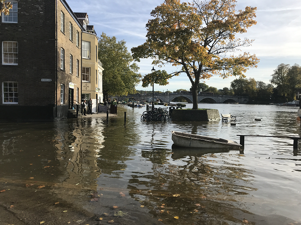
Temperatures along the River Thames are mild all year round and should not deter walkers. The weather in the south-east of England is very different to the north. Keswick, in the Lake District, receives almost twice as much rainfall as along the Thames. It’s also warmer, with temperatures similar to northern France. The main problem is flooding.
From February onwards, rain falls are generally below 30mm, the driest months being June and July. From October to January, rainfall increases to around 40mm per month. The land around the Thames is generally low lying and there is therefore frequent risk of flooding after heavy rains. The Thames does not burst its banks. Instead the surrounding land slowly soaks up water until, once saturated, pockets of water appear randomly on the ground. As the ground gets wetter, the pockets become larger and gradually join up until vast areas can be under water. We post weather and flood alerts on a regular basis.
The most likely time for flooding is actually in two of the driest months: February and March. This is because the persistent heavy rain from October to January has left the ground saturated. The ground then dries out over spring and summer.
The best times to walk are May, June and September as these are not too hot and lie outside the school holidays. April is also quiet but there can still be some flooding. If not flooding, it can get very muddy. The areas most protected are those that are most densely populated. Therefore the likeliest places to see flooding is between the source and Oxford.
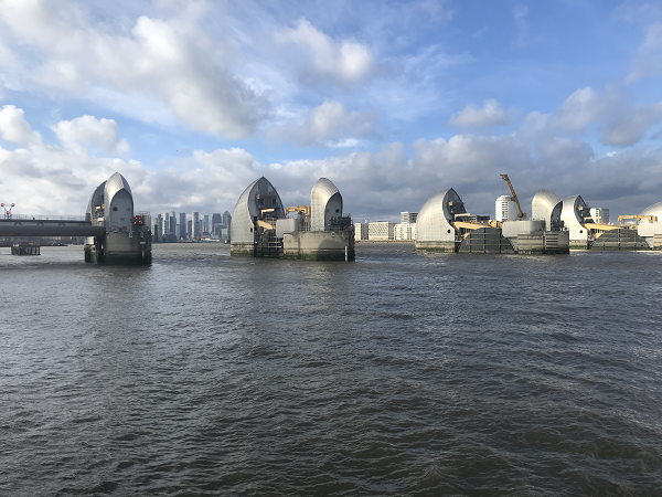
The Thames has a series of flood defences. The weirs are controlled to manage the water levels. But there’s only so much they can do. The Thames Barrier, found at the end (or the beginning!), does the opposite. The Thames is tidal from Teddington (between Kingston and Richmond) and the barrier prevents tidal and storm surges flooding London.
Don’t be put off by the rain: 30mm of moderate rain in a month is only 12 hours. It rarely rains for long!
Thames Path: Which Way? Which Side?
It really doesn’t matter. Most people start at the source and make their way downstream which has the dramatic finale of London. There is a minor advantage of walking eastwards with the prevailing winds behind you. And, technically, its downhill, although the average gradient is negligible. But there is something equally satisfying about walking upstream and see the river gradually getting smaller until it becomes a trickle. Whichever way you decide, we can support you.
For much of the section in London you have the choice of which river bank to walk on. Generally speaking, the left bank contains more of the familiar landmarks: the Houses of Parliament, St Paul’s Cathedral, Tower of London to name a few. Unless you are planning on visiting any of these attractions, we would therefore recommend walking on the south bank which gives the best view.
Note that we used the words north and south bank. The river generally runs east to west but, as everyone knows, makes some big loops so, at times, also runs north and south. Therefore north bank and south bank can be quite confusing. On our route planner we use right bank and left bank: the right bank being the side of the bank that is on the right when walking downstream.
Whichever way you decide to walk, we are here to help you with accommodation, baggage transfer, transportation and anything else you might need. See our How it Works page for more information.