The Thames Path is now in its second week of Tier 2 where hotels and pubs remain open but socialising indoors is forbidden. This makes it hard to truly enjoy what the Thames Path has to offer. So we are all looking forward to normality being restored – hopefully by May. In the meantime it’s likely that, post Christmas, the situation will worsen before it gets better, with talk of London being placed into Tier 3. So what better time to start planning next year’s walking holidays.
Another week has gone by without any flood alerts. The occasional rainy day has contributed to some rising river levels but no more than usual at this time of year. Paths remain dry although becoming muddy.
Rain is forecast for the next few days so the situation could quickly change. Stay tuned to our Route Alerts page.
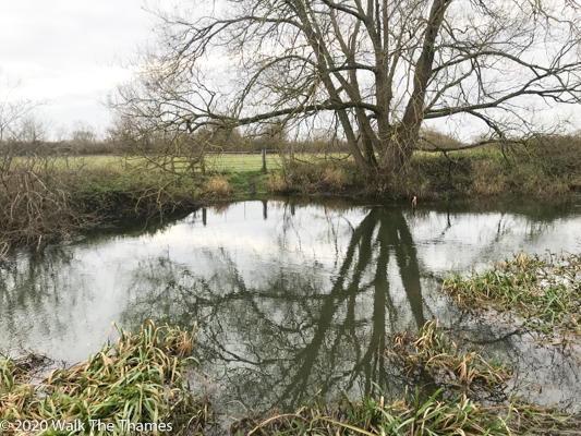
If venturing away from the Thames Path beware of fords, especially in the upper Thames area. The picture below was taken at a point where a footpath crosses Great Brook near the Thames. The water level was 8 feet high!

The Illuminated River walking tours have recommenced. These are guided tours along the Thames Path for a maximum of 6 people. The Illuminated River project is designed to light up 14 bridges along the Thames through London.
This Saturday, December 12, Southwark Cathedral will host the Merbecke Choir who will perform a musical portrayal of Mary’s journey from The Annunciation to the birth of Jesus, with various works old and new. This is a live socially-distanced performance. Limited tickets available. Southwark Cathedral is on the right-bank route of the Thames Path between Westminster and Tower Bridge.
We wrote in a blog about the plight of the eel which was once prevalent in London and a source of cheap protein for Londoners (Eel pie anybody?) but is now endangered. Thames Rivers Trust, who are leading the Thames Catchment Community Eels Project, has been awarded a grant from the UK government. Hopefully more details to follow.
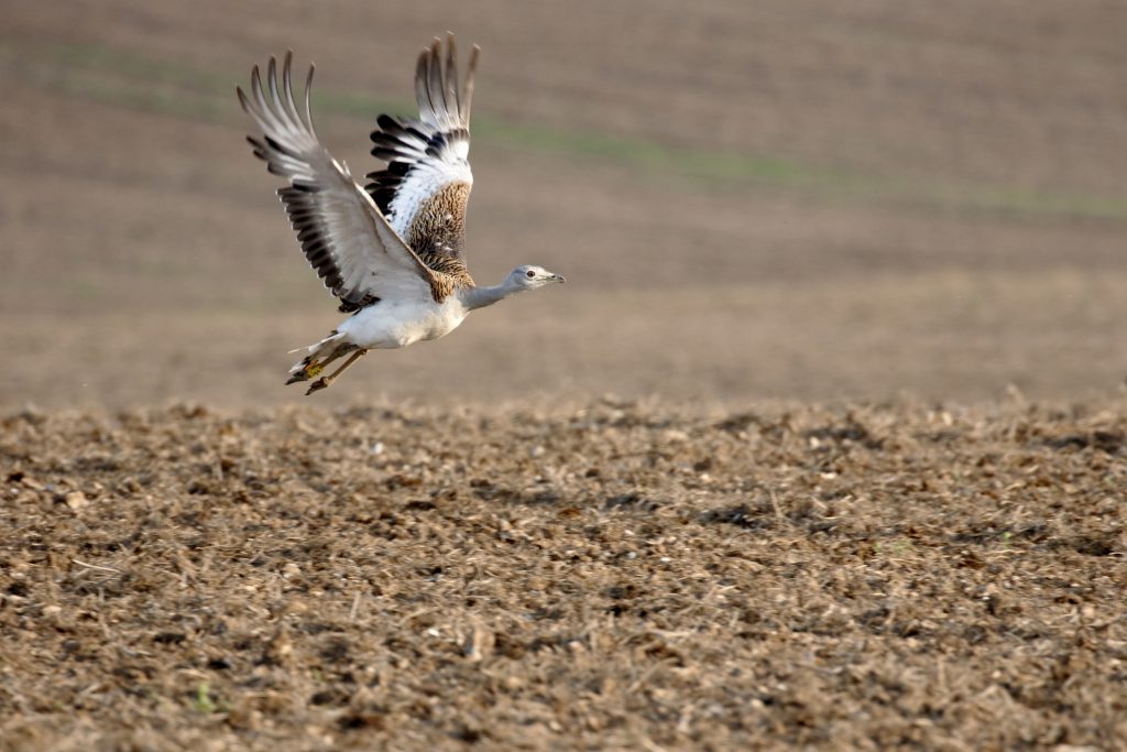
A Great Bustard has been spotted at Letcombe Regis in Oxfordshire. These enormous birds, thought to be native in Britain, were shot to extinction in 1832. Weighing around 20kg they are one of the heaviest flying birds. They enjoy a habitat of open grassland, being most populous on the Russian Steppes. Over the last 15 years there has been a program of steady reintroduction on Salisbury Plain. This has involved the hand-rearing of chicks which were subsequently released. It is believed there are now about 100 self-sustaining birds.
Letcombe Regis is about 8 miles south of the Thames at Tadpole Bridge, some distance from Salisbury Plain which is on the other side of the M4. It’s therefore entirely possible that there may be a sighting on the Thames Path, although the Ridgeway’s habitat is probably more suitable.

The remotest part of the Thames Path is, surprisingly, not near the source. The towns and villages of Kemble, Ashton Keynes, Cricklade and Lechlade provide food and shelter for the hungry and weary. Past Lechlade as far as Eynsham, near Oxford, such opportunities become limited: Buscot, Kelmscott, Radcot, Tadpole Bridge, and Bablock Hythe all offering accommodation but very little else. In the heart of this stretch are Tadpole Bridge and Newbridge, the 6 miles n between being perhaps the remotest spot.
Tadpole Bridge is simply a bridge with a pub, albeit a very good one. The Trout is a fine place to stay and is classified as gold in our packages. The car park is large and they don’t seem to mind if you leave your car there for the day. But if you do, at least have a cup of tea, or something stronger, in the beer garden overlooking the river at the end of your walk.
There is nothing else at Tadpole Bridge. However, two miles to the south is the pretty village of Buckland which has a fine inn, The Lamb. Nearby Buckland House is a grand palladian-style home built in 1757 by John Wood the Elder. Wood’s better known work is the Royal Crescent in Bath. The house, which is privately owned, can be seen over your shoulder as you walk downstream.
Leaving Tadpole Bridge, the Path follows the left bank of the Thames. On a hot summer’s day, this is a popular spot for swimming. After just 1.6 miles you reach Tenfoot Bridge, built in 1869. There used to be a weir here which was 10 feet wide. The weir contained a flash lock where wooden boards held the water back but could be lifted up to release boats going downstream. Upstream boats would have to be hauled by ropes.
The bridge leads to a path running parallel to the Thames, from Buckland (behind you) to Duxford (ahead). This is a useful path if the Thames Path is particularly wet, especially as Duxford, although devoid of facilities, is “as pretty as a chocolate box”
Past Tenfoot Bridge, the Path remains on the left bank. We have now entered the nature reserve of Chimney Meadows, Berks Bucks & Oxon Wildlife Trust’s (BBOWT) largest reserve in Oxfordshire. There are 308 acres of protected land here which provide a vital refuge for wading birds. An observatory has recently been placed close to the river and the Path. It makes a great place to shelter if caught in rain!
Close to the observatory is a World War II pill box. This was part of the GHQ defensive line built to slow down a German invasion. You see many of these along the Thames Path, the river being a natural defensive barrier acting like a moat. This particular pillbox is interesting as it contains a sign saying “No Mooring”. And yet the pillbox is a good 20 metres from the river. Has the river moved? Or has it subsided?
A little over a mile from Tenfoot Bridge the river splits. The Thames meanders off to the right (south) towards Duxford whilst the Path follows a man-made cut directly to Shifford Lock where it rejoins the natural Thames. In the middle of this cut is a footbridge where the Path crosses to the right bank of the Cut. The bridge carries a footpath from the hamlets of Chimney (on your left) to Duxford on the far side of the natural Thames via a ford. There are no shops, cafes or pubs in either Duxford or Chimney so most walkers will march on here, passing through the wooded landscape until reaching Shifford Lock where we are reunited with the natural Thames.
It’s a 2.7 mile walk from Shifford Lock to Newbridge and there is little of interest other than the chance to admire the meandering Thames as it makes its way through the Oxfordshire countryside. The hamlet of Shifford can be seen across the river with a distinctive Grade II listed chapel. Further on, also across the river but not really visible, are the lakes of Standlake Common which are also a nature reserve with a number of bird hides. There’s no access from the Thames Path but you can reach it via a path leading from Newbridge.
Finally, we reach Newbridge, the second oldest bridge across the Thames having been built in the 13th century, the oldest bridge being Radcot further upstream. There are two hostelries here: the Maybush and the Rose Revived. The Rose Revived, which offers accommodation, is so named because Oliver Cromwell drank here whilst on his Civil War campaigns (the Battle of Newbridge was fought in 1644). He ordered an extra tankard of ale and placed in it a drooping rose that he had been wearing. The rose revived.
Quintin Lake, who this year successfully completed his 6,600 mile walk around the coastline of Britain, has been awarded Gold in the Outdoor Magazine’s Personality of the Year Award. No, it wasn’t a continuous walk. He started in 2015 walking in sections for 3 months at a time and covering 12-24 miles per day. His worst moments were a torn tendon and shin splints. Surely he must have had blsiters!
Ready to book?
| Cookie | Duration | Description |
|---|---|---|
| cookielawinfo-checkbox-analytics | 11 months | This cookie is set by GDPR Cookie Consent plugin. The cookie is used to store the user consent for the cookies in the category "Analytics". |
| cookielawinfo-checkbox-functional | 11 months | The cookie is set by GDPR cookie consent to record the user consent for the cookies in the category "Functional". |
| cookielawinfo-checkbox-necessary | 11 months | This cookie is set by GDPR Cookie Consent plugin. The cookies is used to store the user consent for the cookies in the category "Necessary". |
| cookielawinfo-checkbox-others | 11 months | This cookie is set by GDPR Cookie Consent plugin. The cookie is used to store the user consent for the cookies in the category "Other. |
| cookielawinfo-checkbox-performance | 11 months | This cookie is set by GDPR Cookie Consent plugin. The cookie is used to store the user consent for the cookies in the category "Performance". |
| viewed_cookie_policy | 11 months | The cookie is set by the GDPR Cookie Consent plugin and is used to store whether or not user has consented to the use of cookies. It does not store any personal data. |