What counties does one encounter whilst walking the Thames Path? Well, that rather depends on your definition of county!
For hundreds of years England was divided into 39 counties for administrative purposes. They originated as either kingdoms (Kent) or parts of ancient kingdoms such as Wessex and Mercia. Some of these date back to Roman times. Following the Norman invasion of 1066, these partitions were formalised into shires, with sheriffs placed in command. The name “counties” fell into use later when the sheriffs were replaced with counts.
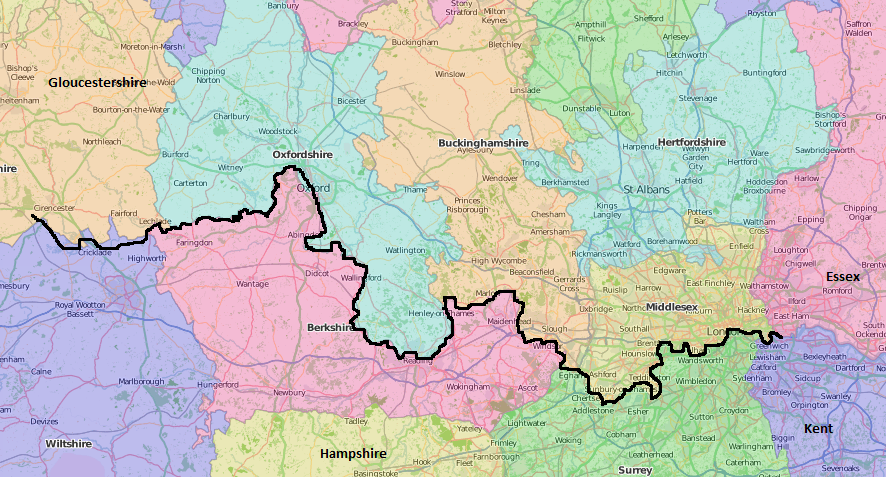
Today, most of the old boundaries have gone. Some minor changes were made in 1888 with the Local Government Act but its 1972 successor created “administrative counties” that differed significantly from the historic counties, some being brand new: Avon, Cleveland, and Humberside for example. The Lieutenancies Act of 1997 redefined “ceremonial counties”. Lord Lieutenants are in place to organise any visits by the Royal Family to their county. Ceremonial counties differ from their historic counterparts in terms of both borders (for instance Berkshire has given over a large amount of land to Oxfordshire) and in composition: there’s no Westmoreland amongst the ceremonial counties but there’s a Greater Manchester. And Yorkshire has been broken up!
The Association of British Counties (well, there had to be one hadn’t there) promotes awareness of the historic counties. The Association believes “that Britain needs a fixed popular geography, one divorced from the ever changing names and areas of local government but, instead, one rooted in history, public understanding and commonly held notions of community and identity”. In deference to them, and in view of the fact that county cricket is based on historic boundaries, for the purpose of this exercise we have used the historic boundaries.

The historic counties were often divided by rivers or roads and the Thames is a good example of this. For the vast majority of its journey, the Thames forms a natural boundary between counties.
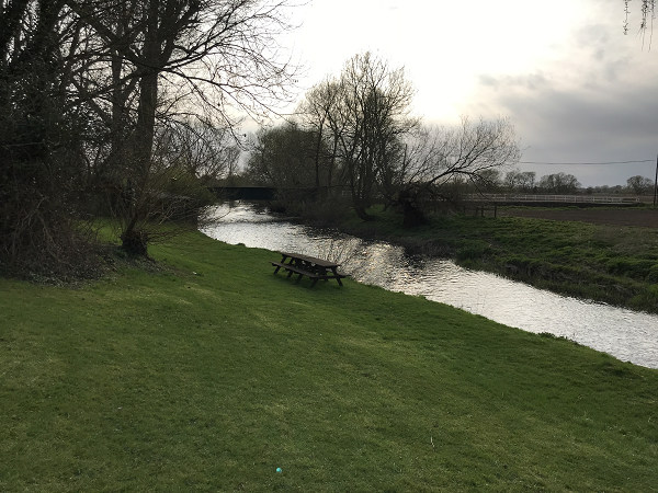
One exception, however, is at the very beginning. The Thames rises in Gloucestershire. Just! In fact, the source is just 0.5 a mile inside Gloucestershire, the border with Wiltshire being the A433 running between Tetbury and Cirencester. Here the Thames is just a stream, hard to find at times. The dead straight A433 heading for the ancient Roman city of Cirencester is part of the Fosse Way, linking Exeter with Lincoln, a more better candidate for a border.
Gloucestershire is 17th in the county league table by area. Naturally its county town is Gloucester although the historic county extends to Bristol to the south. Wiltshire, 14th in the table, is a farming county famous for pigs, Stonehenge and Salisbury Cathedral.
South-west of Cirencester the border between Gloucestershire and Wiltshire seems to be rather random. And, apart from a momentary lapse of concentration when the Thames Path strays back into Gloucestershire for less than a mile, the path remains in Wiltshire until Castle Eaton where the river is now properly formed and we have a natural boundary.

Wiltshire gives way to Berkshire just before Lechlade whilst Gloucestershire gives way to Oxfordshire after Lechlade. Berkshire, one of the smallest counties in England, is the only one with Royal status, granted in 1957 on account of Windsor Castle. Oxfordshire, slightly larger, is dominated by its capital. Until we reach Oxford, the river separates this pair of counties. Each time we cross the river, we change counties: at Radcot, Rushey Lock, Shifford Lock, Newbridge, and Pinkhill Lock. As the Thames carries out its large loop around west Oxford so the border continues with it.
But wait, surely the Berkshire border does not run through the centre of Oxford? Well, no it doesn’t. At Godstow, the border politely backs off from the river to give Oxfordshire’s capital city some breathing space although it rejoins it at Abingdon Bridge, a stone’s throw south of Oxford. We now find ourselves back in Berkshire as the Thames Path follows the right bank.
Once again, as we travel south from Oxford, each time we cross the river we move between Oxfordshire and Berkshire: at Abingdon, Clifton Hampden, Dorchester, Benson, Goring, and Pangbourne.
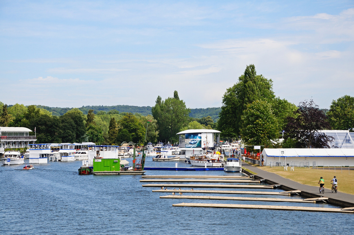
Reading is the county town of Berkshire. The river turns north from here as it performs its “Henley loop”, meandering for 32 miles past Henley, Marlow and Bourne End before travelling south again to reach roughly the same latitude at Windsor, just 15 miles away as the crow flies. It’s during this loop that we say goodbye to Oxfordshire a mile north of Henley (although we’re in Berkshire when it happens!) and Buckinghamshire takes over on the left bank. We finally step into Buckinghamshire when we cross to the left bank at Hurley.

Buckinghamshire, like Berkshire, is small, coming 33rd in the land league. Also like Berkshire, it’s a “home county” being one that adjoins London. Buckinghamshire was part of the Kingdom of Mercia and is named after the town of Buckingham in the north.
We cross back into Berkshire just past Bourne End as the river works its way south with Buckinghamshire on the opposite side. There we remain (except for the stretch between Maidenhead and Windsor which is wholly in Buckinghamshire) until we reach Runnymede.
Here, responsibility for the right bank (where we are currently walking) is handed over to Surrey and, by the time we cross over to the left bank at Staines, Middlesex has taken over from Buckinghamshire. The Ceremonial County of Surrey is the 12th most populous and also the most wealthy. It was conquered by the Saxons in the 5th and 6th centuries. Today, they say, it is ruled by 4×4’s. We now play ping pong between Surrey and Middlesex all the way into London, crossing back into Surrey by way of a ferry at Shepperton, back to Middlesex at Hampton, and to Surrey at Richmond. From Richmond you have choice of left or right bank. Or, rather, Middlesex or Surrey?
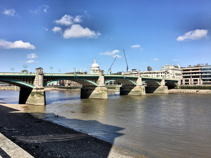
Surrey terminates at Greenland Dock between Tower Bridge and Greenwich. Nearby Surrey Quays is a clue! It therefore includes some of the most deprived parts of south London, not fitting with our current day image of stockbroker Surrey.
Kent is now our county on the right bank and, from Greenwich, we have no left bank option. This makes our eighth and final county – although we can admire the view of Essex across the water anywhere downstream from Greenwich Peninsula. Kent is the 9th largest county and became a kingdom in the 6th century, its capital being Canterbury, Cant and Kent being interchangeable. Our Path finishes at the Thames Barrier. But, as the song goes, the mighty river rolls on into the North Sea, separating Kent and Essex at all times.

Ready to book?
| Cookie | Duration | Description |
|---|---|---|
| cookielawinfo-checkbox-analytics | 11 months | This cookie is set by GDPR Cookie Consent plugin. The cookie is used to store the user consent for the cookies in the category "Analytics". |
| cookielawinfo-checkbox-functional | 11 months | The cookie is set by GDPR cookie consent to record the user consent for the cookies in the category "Functional". |
| cookielawinfo-checkbox-necessary | 11 months | This cookie is set by GDPR Cookie Consent plugin. The cookies is used to store the user consent for the cookies in the category "Necessary". |
| cookielawinfo-checkbox-others | 11 months | This cookie is set by GDPR Cookie Consent plugin. The cookie is used to store the user consent for the cookies in the category "Other. |
| cookielawinfo-checkbox-performance | 11 months | This cookie is set by GDPR Cookie Consent plugin. The cookie is used to store the user consent for the cookies in the category "Performance". |
| viewed_cookie_policy | 11 months | The cookie is set by the GDPR Cookie Consent plugin and is used to store whether or not user has consented to the use of cookies. It does not store any personal data. |