Flood Alerts
Thames Path Flood Alerts
Here we attempt to keep you updated on any flood alerts on the Thames Path. A number of spots along the Thames are prone to flooding. We will keep the list at all times and provide the latest update. If the latest update appears old, don’t worry. This page is regularly monitored. Pictures are not current but demonstrate what it can be like when flooded.
We’ve recently produced a guide book specifically directed at how to avoid flood spots – of which there are many. You can purchase this guidebook at our shop.
Update 19/1/26: some flooding in the Upper Thames. Conditions have improved since this time last month but still very wet in places.
Update 22/1/26: No major flooding issues downstream from Newbridge except around Clifton Hampden. However, water levels are high and there will be isolated patches of standing water here and there. Outlook is not good as river is continuing to rise, swelled by recent rainfall. Further rain forecast. Widespread flooding is highly likely within next 2-3 days.
Update 29/1/26: We are away at the moment so unable to perform inspections. Any updates are currently derived from other sources. It’s fair to say that much of the Thames Path, probably as far as Cookham, is at high risk of flooding.
-
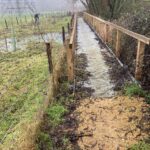 Ewen 2.5 miles
As of 19/1 the path from Ewen to the boardwalks under the pylon are clear of water - a distinct improvement from a month ago. The boardwalks are doing their job!
-
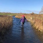 Water Hay 8 miles
Car park and surrounding paths under water as of 19/1/26.
-
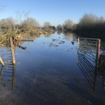 Field before North Meadow 11 miles
The field between the disused railway and North Meadow is certain to be flooded as all of North Meadow is. You can avoid this by following the disused railway (cycle route 45) into Cricklade.
-
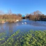 Cricklade A419 Underpass 12 miles
As of 19/1/26 the underpass is completely flooded.
-
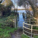 Cricklade to Castle Eaton 14-16 miles
The fields between Cricklade and Castle Eaton are completely under water and impassable.
-
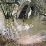 Shifford Lock 37 miles
As of 19/1/26 the bridge at Shifford Lock is impassable. Picture current.
-
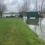 Newbridge 39 miles
Update 22/1: Path keeping its head just above water! Current photo.
-
 Bablock Hythe 43 miles
As of 22/1 Path approaching Ferryman at Bablock Hythe is clear although lake coming in from the left is rising. Current photo.
-
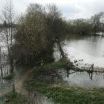 Clifton Hampden 68 miles
Path both upstream and downstream from Clifton Hampden are flooded as of 22/1/26. Photo not current.
-
 Cholsey Meadows 78 mies
Intermittent flooding through Cholsey Meadows. Photo not current.
-
 Goring 82 miles
Just downstream of Goring, around Gatehampton, the fields are flooded. Photo not current. We think the tow path at Goring is likely to be flooded also. Photo not current.
Ready to book?

