How to Get There
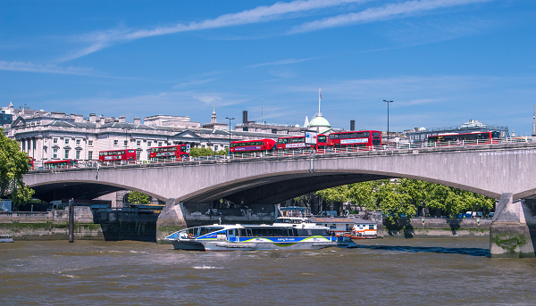
Generally speaking the Thames Path is quite well served by public transport. Here we explore the public transport links of each of the 5 sections:
Source to Oxford
As you might expect this is the least well-served of all the sections on the route. Oxford itself has excellent connections with trains to London and Birmingham. The only other station that is close to the Path is Kemble, which is very close to the source. There are no train services to locations between the source and Oxford. However, there are bus services from Cricklade and Lechlade to Swindon

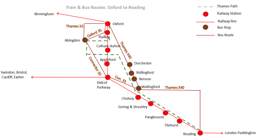
Oxford to Reading
The railway follows the river for much of this section except that the Thames makes a large loop around Abingdon whilst the train follows a direct route.
Also note that Culham and Appleford stations are both some way from the Path. And the Thames Path at Appleford is on the other side of the river with no bridge. There are no train services at both these stations on Sundays.
From Cholsey to Reading, the Path and the train line meet each other at regular intervals.
Reading to Staines
This section is well served with stations. The longest section without a station is Henley to Marlow which is just 9 miles.
Windsor has 2 stations: Central, which is a branch line from Slough; and Riverside which connects with other Thames Path stations downstream.

Staines to Richmond
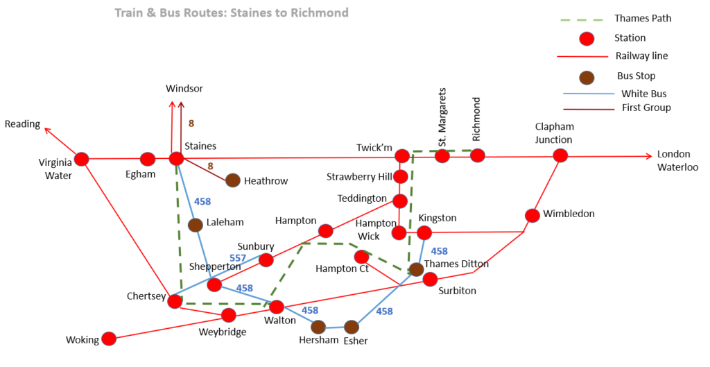
As you approach the outskirts of London, the train stations become quite frequent. Up until this point, trains have been served by Great Western Railway from London Paddington. Now we are in South-West Railway territory operating out of Waterloo.
Because the stations along the Thames Path are often on different lines, it’s not always straightforward to move between stations along the Path. For instance, a train from Hampton Court to Kingston, a walk of just 3 miles, can take half an hour.
A quick note on the accessibility of the stations: Shepperton and Sunbury are both on the “wrong” side of the river and some distance away. Weybridge and Walton are on the “right” side of the river but still some distance away. Chertsey is also a bit of a hike from the river.

Richmond to Woolwich
The final section of the Thames Path is well served by trains as the diagram below illustrates. A combination of rail and tube will get you up and down the path although you may have to change lines frequently.
South-West trains service the right bank stations of Richmond, Mortlake, Putney, Wandsworth, Battersea Park and Waterloo.
The left bank is not quite as well serviced until you reach Westminster when the district and circle lines run parallel to the river until Tower Hill. The Jubilee runs in a similar direction between Waterloo and London Bridge.
Greenwich can be reached either by rail from London Bridge, or via the Docklands Light Railway which provides glorious views as it winds its way around the glass towers of Canary Wharf.
Woolwich is well served by trains boasting three mainline stations. The newest, simply called Woolwich, is the end of the Elizabeth Line which is the quickest way back into central London.

Uber Boat by Thames Clippers
The Thames Clippers service runs up and down the river from Putney down to Woolwich with 22 stops in between. It’s a great way of travelling about. Just be aware that the frequency of service is less at the two ends. And, as it’s designed for commuters, there’s a reduced timetable at weekends.
Nonetheless, taking the worst case of travelling upstream from Woolwich back to Greenwich, you still have a service every 30 minutes with the last one being 2040.
Payment is straightforward. Simply swipe on and swipe off with a debit card. No need to book tickets ahead.
